| Day Two: | South Cove/Cape Arago |
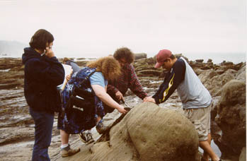 |
The rocks at Cape Arago have been tilted
and
faulted. To the left, Melinda trying to show Cami, Nate and Karim how to get a strike and dip measurement using a Brunton compass. Picture taken by Melissa Riopel. |
 |
 |
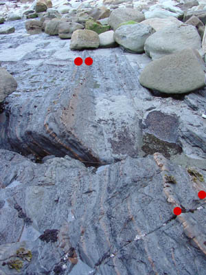
| The various coves and bays in the area are
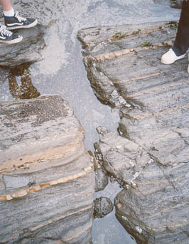
the result of erosion along fractures and faults. In the figure above, I've stuck little red dots on two sandstone layers that are offset along a fault. Cami Idzerda's picture of the same fault (upper right) shows that erosion preferentially occurs along the faults, leaving linear channels and tidepools in the wave-cut platform. The picture to the right shows that there is a series of fractures/ faults, rather than one single one, and also shows the long water filled channels that result. |
 |