Guides
HTML documents
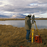
Equipment
- Available equipment. Surveying equipment available in the Geology Department.
- General Guide (PDF format)
- Manuscript on surveying (PDF format with low-res figures)
- Instructions for setup and use of Sokkia SET 4BII Total Stations
- SDR33 Electronic notebook setup checklist.
- Altimeter
Surveying procedures
- Instructions for precise surveying of a quadrilateral. Details on procedures for measuring angles and distances. Methods involve multiple measurements of the same angle, and averaging / checking procedures.
- Methods for balancing a traverse. Some ways in which you can adjust distances to 'close' a traverse (e.g., a quadralteral)
- Instructions for using an Electronic Total Station as a Plane Table (control-point mapping).
- Using Surfer to plot base maps for control-point mapping
- Using ArcView to plot base maps for control-point mapping
- Importing data into an ESRI Geodatabase using Survey Analyst
PDF Documents
- Introduction to total stations and basic surveying techniques. A tutorial on how total stations work, and basic procedures for measuring angles and distances.
- Total Station setup checklist. A checklist of things you should do when setting up an instrument station
- Form for collecting field data. This form will remind you of the data you need to record
Power Point Presentations (by Sokkia)
Software
The following software is available for non-commercial purposes. The software is copyrighted material. See our copyright policy. Although we welcome comments and suggestions regarding these programs we do not provide technical support.
Please acknowledge the role of NSF in supporting development of these programs in publications.
General Utilities & Sample workbooks
- Microsoft Excel workbook showing how to correct F1/F2 angles and summarize data from a quadrilateral survey.
- Microsoft Excel workbook showing simple coordinate corrections for a quadrilateral
- Microsoft Excel workbook for least-squares adjustment of a braced quadrilateral
- Microsoft Excel workbook for least-squares adjustment of a triangle
- Microsoft Excel workbook showing how to rotate a survey network.
- Microsoft Excel macro to convert between UTM and Latitude/Longitude uses North American Datum 1927, so it is useful for working with USGS topo sheets.
- FORTRAN programs from Smith and Varnes (1987) for adjustment of a triangle or quadrilateral. These programs require ISML routines
Software supporting PSU hardware
- Microsoft Excel Add-In to read and decode Sokkia SDR electronic notebook files. Available for Excel 5.0/95 or for Excel 97. Works with both Macintosh & Windows versions of Excel.
External Links
- Land Surveying Software Resources. Many links to surveying-related sites. Many contains software.
- National Geodetic Survey. This site has useful programs for survey corrections and coordinate system conversions
- U.S. Geological Survey National Mapping Division. More mapping and surveying-related software.
References
Baum, R.L., Johnson, A.M., and Fleming, R.W., 1988, Measurement of slope deformation
using quadrilaterals: United States Geological Survey Bulletin 1842-B, 23 p. A useful technique for monitoring hillslopes.
Brinker, R.C., 1969, Elementary surveying (Fifth ed.): New York, International
Textbook Company.
Compton, R.R., 1985. Geology in the field: John Wiley & Sons, New York.
398p.
Davis, R.E., and Foote, F.S., 1940. Surveying. Theory and Practice. Third
Edition: McGraw-Hill, New York.1032p. An old book, but many of
the procedures are still the same today. Compare some of the material with Moffitt &
Bouchard.
Lahee, Frederic H., 1941. Field Geology. Fourth Edition: McGraw-Hill, New
York.853p. see chapters XIV-XVII, pages 395-558, on Geologic
Surveying. Although this is before Total Stations, the methods of surveying are still
similar.
Moffitt, F.H., and Bouchard, H., 1992, Surveying. Ninth Edition: New York, New
York, Harper Collins, 848 p.
Smith, W.K., and Varnes, D.J., 1987, Least-squares adjustment of triangles and
quadrilaterals in which all angles and distances are observed: Surveying and Mapping,
v. 47, no. 2, p. 125-142. A methods that uses both triangulation
and trilateration to refine measurements on a quadrilateral. See in reference to the
methods discussed in Baum, Johnson & Fleming.