| Site # |
JM07 |
|
|
| Information utility |
high |
|
Date 12/29/09 |
| Description |
Head of gorge with multiple wells and catch dams |
|
|
| Nearest Village |
El Jocote |
|
|
| GPS coordinates |
N 12 31.261 |
W 85 51.805 |
|
| Elevation (ft) 1767 |
|
Slope 10 (looking upriver to top of ridge) |
|
| Photos from Jazmin's camera |
Folder name |
|
|
| |
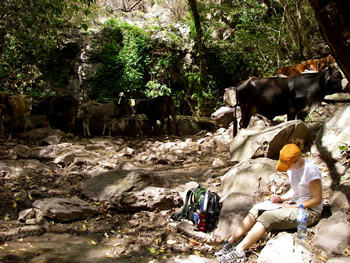 |
| North facing (0 degrees) |
5533/JM07_N_12-29-09_JO.JPG |
East facing (90 degrees) |
5534/JM07_E_12-29-09_JO.JPG |
| South facing (180 degrees) |
5535/JM07_S_12-29-09_JO.JPG |
West facing (240 degrees) |
5536/JM07_W_12-29-09_JO.JPG |
| Sketches by Patrick #2,3 |
|
|
|
| Vegetation |
|
|
|
| |
Trees and shrubs, including: dragonfruit, ferns,
quebracho, melero, panagua, quitacalzonte, guaruma, quebracho. |
|
|
| Water |
|
|
|
|
2 wells, 3 check dams and several springs in
immediate vicinity. Closest home nearby is within 100 meters and belongs to
Zacharia Jurbina, who owns the property surrounding the wells. |
|
|
| |
Seasonal creek crossings, private property and rough
terrain can form barriers to accessibility. |
|
|
| Human Accessibility |
|
|
|
| |
Site is used for laundry, bathing, drinking water,
livestock consumption. There is a very healthy riparian zone throughout the
canyon. |
|
|
| Land Use |
|
|
|
| |
Site is used for laundry, bathing, drinking water,
livestock consumption. There is a very healthy riparian zone throughout the
canyon. |
|
|
| Soil sample results |
|
|
|
| pH 6.5 |
Nitrogen 10 lbs/acre |
|
|
| Phosphorous 10 lbs/acre |
Potassium 300 lbs/acre |
|
|
| Water sample results |
|
|
|
| pH 8 |
Nitrogen 0 ppm |
Phosphate 4 plus ppm |
|
| Coliform negative |
Dissolved Oxygen 5 ppm |
|
|
| According to Antonio, the springs are
always full. In one of the small wells, about 3 feet deep, there were very
small little fish. During the dry season there are frogs also. The dams have
been here since at least 1970, the upper one is fenced to prevent livestock
from intruding. One source of water appears to be in a cave. The owner of the
property allows his family, perhaps only his sons, (about 7 families) to use
the water in the canyon. Everyone helps take care of the gorge. |
According to Antonio the retention dams and wells in
this zone used to have fish but no longer. We did see very small little fish
that resembled tad poles. Additionally, we see filamentous algal growth
around the perimeter of the spring. |
According to Antonio the cave to the right of the
retention dam is the source of the water from upstream streams. |
|