http://web.pdx.edu/~rueterj/courses/esr220/lab/tidewood-johnson.html

TIDEWOOD-JOHNSON |
|
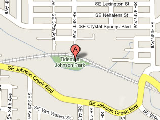
Location:The Tidewood-Johnson Park is located right off the Springwater Cooridor (SWC) bike trail just a short bit downstream from where Johnson Creek Blvd crosses at SE 45th. There is a convenient parking lot at this (East) end of the trail. Otherwise, by car the nearest access is probably from SE 37th or 39th. The railroad tracks in the map (right) is the SWC.
|
 |
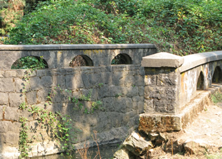
Interesting points:Along the corridor coming in from the east, you can see how Johnson Creek was channelized and has stone structures directing and changing the flow. In Tideman-Johnson Park the flow is allowed to go along much more natural banks. There has been an extensive amount of removal of invasive species (Him. Blackberry) and planting of native species.
|
 |
Possible sampling points:There are bridges and access points all along the Springwater Cooridor in this region of the stream. Just east of SE45th and Johnson Creek Blvd, Errol Spring contributes to the flow and chemistry. Remember:
|
|
woody debris in Johnson Creek upstream from the Tidewood-Johnson Park (Sept 17, 2008) |
Links to other data and references:1. nearest USGS gaguing and monitoring sites are:
2. More information on the restoration effort is available from:
|