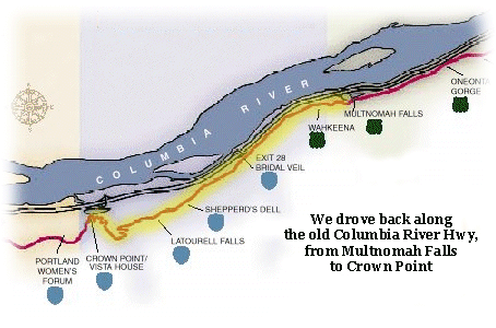
 Once
we got back down the trail and got back in the car, we headed westward along the
“Historic Columbia River Highway,” which is what’s left of the original Columbia
River Highway.
Once
we got back down the trail and got back in the car, we headed westward along the
“Historic Columbia River Highway,” which is what’s left of the original Columbia
River Highway. Sunday, November 17 ... part II ...
Once
we got back down the trail and got back in the car, we headed westward along the
“Historic Columbia River Highway,” which is what’s left of the original Columbia
River Highway.
It was constructed between 1913 and 1922, along the (quite) steep cliffs of the Columbia River Gorge, and was a technological tour-de-force when it was constructed. Today, what's left of it sort of runs most of the way between Portland and The Dalles, around 75 miles, but only 40 miles of that are drivable -- when the Interstate Highway system was being constructed in the 1950s, many portions of the old highway were tragically demolished, abandoned, or bypassed.
But not all of it, fortunately, and ODOT is currently rehabilitating abandoned segments for non-motorized use as the Historic Columbia River Highway State Trail. So there is hope!
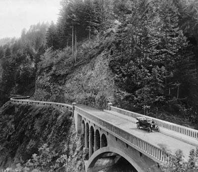
What’s left is pretty cool, in terms of scenery and art-deco-ish bridges, although they are a bit on the skinny side. I didn’t get any pictures as we drove because there just wasn’t enough daylight left to give me anything but blur on camera, so the pictures here are some that I … ahem … borrowed … so no, that's not our car ...
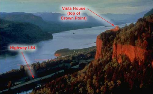 This
picture gives you some perspective on the scales of geography we’re talking
about here – there are serious cliffs, and how they managed to wind that little
road all hither and yon to get from here to there is pretty darn impressive,
even today. The “new” highway, I-84, is fast and relatively straight and pretty
much as boring as you’d imagine. Yeah, it does get you from here to there but
from the road all you see of the Vista House is a tiny speck on the top of the
hill, like in this shot. Take the old highway, though, and you are rewarded
with …
This
picture gives you some perspective on the scales of geography we’re talking
about here – there are serious cliffs, and how they managed to wind that little
road all hither and yon to get from here to there is pretty darn impressive,
even today. The “new” highway, I-84, is fast and relatively straight and pretty
much as boring as you’d imagine. Yeah, it does get you from here to there but
from the road all you see of the Vista House is a tiny speck on the top of the
hill, like in this shot. Take the old highway, though, and you are rewarded
with …
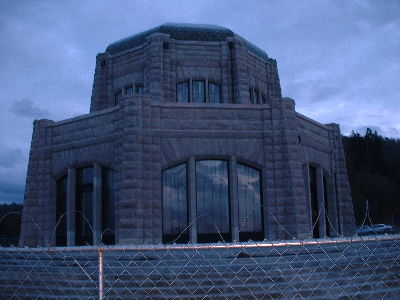
The Vista House! It was built in 1916-1917 as a monument to Oregon pioneers. In case you can’t tell from the picture, we’re 733 feet above the Columbia River, and listed on the National Register of Historic Places. Or, rather, the building is listed. The chain link fence is neither listed nor part of the original design – the building is being renovated and is closed to visitors at the moment, so this is as close as we could get.
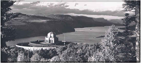
I couldn't get back far enough to give you the Big Picture, as it was, but basically imagine something more like this, although in color.
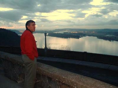
A shot of my dad at Crown Point, with the western skyline in the background. If you’re trying to figure out the exact geography, imagine the Vista House behind me (I’m the one taking the picture) at about eight o'clock on the dial and that’s pretty close.
That's Portland, way in the background, all those little lights in the distance.
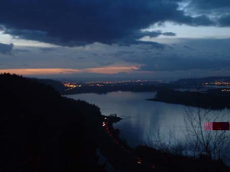
About ten seconds after taking this shot it was totally dark outside, and it wasn't even 6pm; amazing how fast the sun sets this time of year. Also it was more than a bit chilly outside by this time, so we piled back in the car and headed home for dinner and birthday cake.
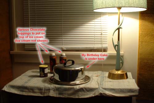
Back at the Ranch (aka My House). Isn't that a great lamp? I picked it up a while ago at an antique shop in Multnomah Village.
Oh, and my dad baked the cake, and it turned out great, especially considering this was only the second cake he'd ever baked in his life.
Chocolate cake, of course.
And presents, I got presents. No pictures of them, sorry, but a cool Agatha Christie book from my friend Kim; "The Peanuts Treasury" from Claudia; and some bike riding gear from my dad.
Thus ended my Grand Day Out 2002. Or close enough.
![]()