Knowledge-Informed Simulated Annealing (KISA)
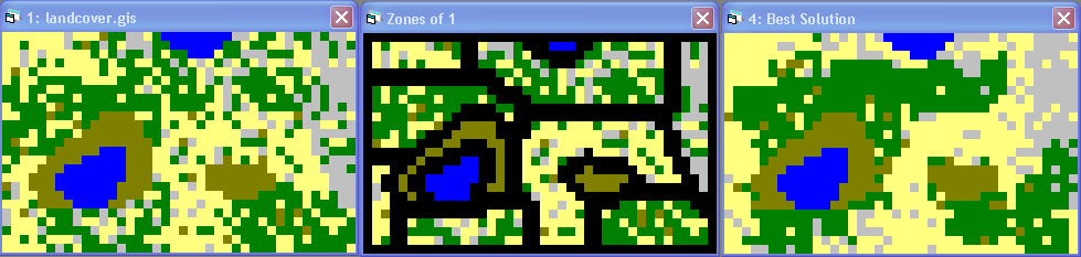
KISA is a tool for generating land allocation solutions that exhibit predefined landscape pattern characteristics. These pattern characteristics could be indictive to certain ecological or socioeconomic functions of the landscape. KISA provides map representations of landscape under design constraints specified by, for example, landscape architects or conservation ecologists so that they could investigate and visualize the relationship between design scenarios and landscape function. The tool can be used for single and multi-objective allocation problems.
KISA Tutorial Data and Documents
|
|
|
Software: MS Windows Installation File
|
|
|
References
|
- 2007. Duh, J.D. and Brown, D.G. Knowledge-Informed Pareto Simulated Annealing for Multi-Objective Spatial Allocation. Computers, Environment and Urban Systems, 31(3): 253-281.
|
- 2005. Duh, J.D. and Brown, D.G. Generating prescribed patterns in landscape models. In: D.J. Maguire, M.F. Goodchild and M. Batty (Eds) GIS, Spatial Analysis and Modeling. ESRI Press, pp 423-444.
|
Contact
|
Geoffrey Duh (jduh@pdx.edu)
Geography, Portland State University.
|
|
|