GEOG 4/575 Lab 7:
Geometric Transformation
Due Nov 19.
You will use ArcMap’s Georeferencing Tools and ArcScan extension to do geometric transformation and vectorization of raster images. These are important GIS data compilation tasks when converting traditional paper maps or remotely sensed images into a GIS database. You can also use these techniques to georeference a GIS data layer whose spatial reference information is missing or inaccurate. As mentioned in the lecture, collecting GCPs is the most challenging step in geometric transformation and requires a lot of experience. Pay extra attention to the step of collecting GCPs when doing this lab.
Finish all tasks in Chang’s Chapter 6.
Answer and submit all questions listed at the end of this exercise. Lab exercise data are available in: I:\Students\Instructors\Geoffrey_Duh\GEOG4575\Chang_5e\chap6 (or on the textbook
CD). Please copy all these folders to your working directory in c:\Users before
you start.
Notes:
Questions:
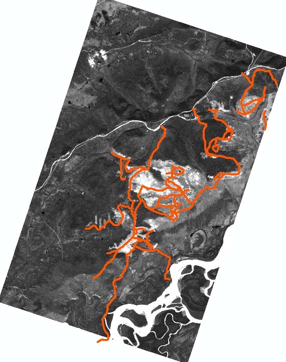
1) Report the RMSE values (including those of individual GCPs) you got in Tasks 1 and 3. Please insert the screenshots of the Link Tables from both Tasks in your report. Also attach a screenshot of the rectified SPOT image superimposed by the roads.
2) Use the properties dialog window to check the projection information of rect_hoytmtn.tif. What is the projection of the rect_hoytmtn.tif image that you just georeferenced?
3) The hoytmtn.tif image contains scanned soil lines. The hoytmtn_trace.shp contains polyline features. If what you need is a soil polygon featureclass, what additional steps in ArcGIS are required to generate the polygon featureclass? Briefly describe the steps and tools you will use. Use ArcGIS online help to find the appropriate tools.
4)
You need a polyline featureclass of the old drainage channels on the east side
of