Large Map
This aerial photograph shows the entire length of the debris flow. The first 900 metres of the scar are where runoff began to accumulate debris (Photographs A, B, & C). At the point where Photograph D was taken the flow entered a deeply incised channel. The flow was confined to this channel for the next 1.2 km, where most of the boulders found in the deposit were picked up. The last 800 meters is where flows spilled out the channel and deposited the debris. The last 800 m of the flow are shown in detail by the large map.
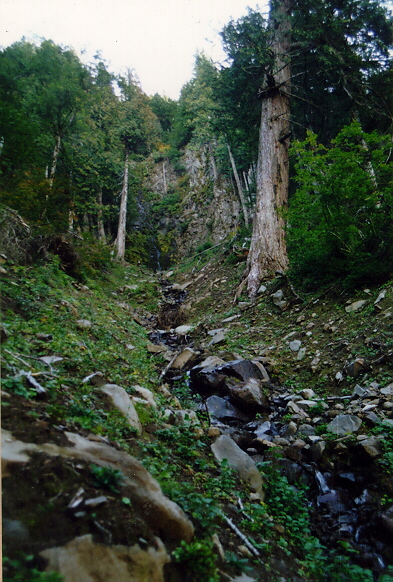
Photo A
View toward the start of the Royse Debris flow channel. The waterfall at the top is a cliff of the High Cascades Andesite. The debris flow appears to have started with stream runoff stripping off the soil on either side of the stream. Levee-like structures in the source area and mostly made up of tree-parts and contain few, if any, boulders (Photo C). The flow continued to pick up mud and woody debris as it continued down slope (Photos B & C). The boulders in the foreground are of the same composition as found in the debris flow deposits, but they are much more angular and broken. The boulders are part of the colluvium, and were not deposited by the flow
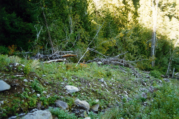
Photo B
View from the same location as photo A, but looking down slope. Note the tree-parts forming a levee. Not much surface material has been removed here.
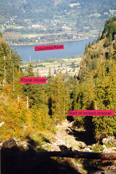
Photo C
View towards the fan from the source area. The Royse house (about 2.4 km away) can just be seen at the bottom. The muddy flow entered a deeply incised channel when it disappears into the trees (from where photo D was taken). The flow remained in this channel until the fan. The large boulders in the deposit were probably picked up by the muddy torrent from the channel.
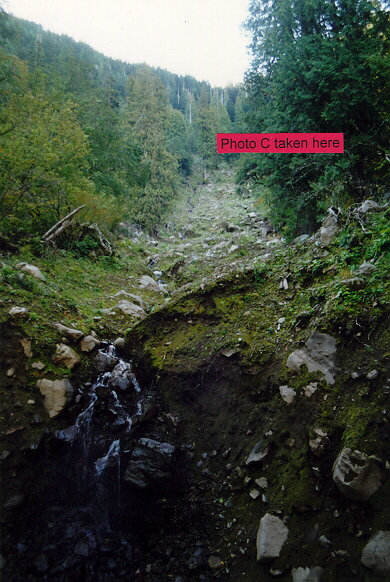
Photo D
View looking up the source area. This is where the flow entered a deeply incised channel. There has been widespread, but not deep, erosion in the slopes above this point. Note the lack of boulder levees. The colluvium that the channel is cut into contains the size and type of boulders seen in the deposit. Note that they are more rounded and weathered than the boulders in photograph A.