Precipitation and Maximum Temperature.
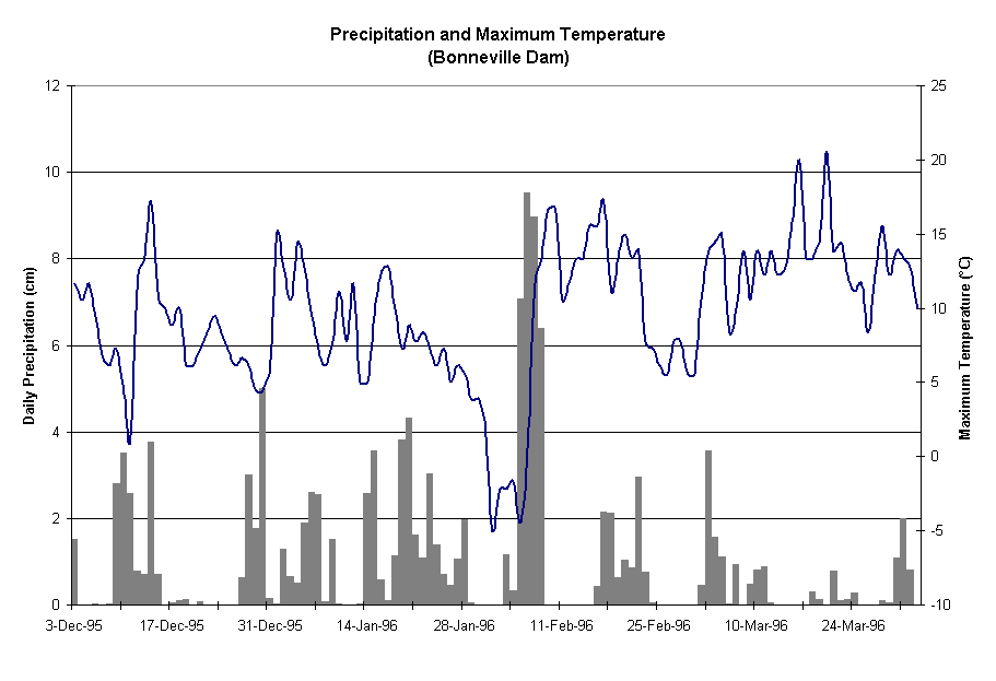
December 1995 - March 1996
Precipitation and Maximum Temperature.
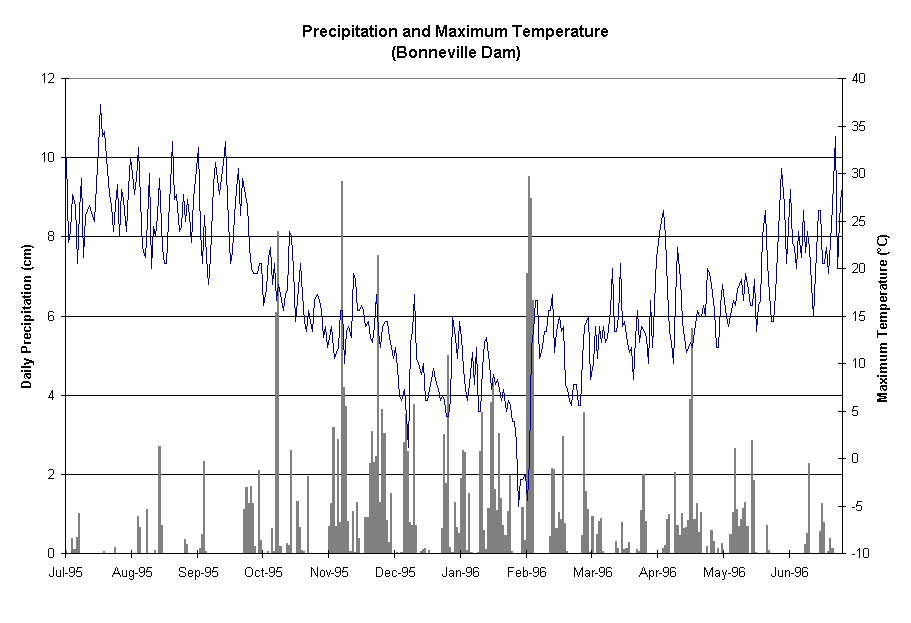
July 1995- June 1996
The Royse debris flows were initiated by runoff from four consecutive days of record rainfall (32 cm in 4 days) combined with melting of the snowpack at higher elevations. The runoff was concentrated in Leavens Creek. In the upper and middle portions of the creek the runoff picked up mud and boulders from the channel and produced a series of debris flows.
Two plots are shown below for precipitation (at Bonneville Dam) and maximum temperature (from Portland International Airport). The first plot is for December 1995 through March 1996. The second plot is from July 1995 to June 1996, showing a whole year of data.
Geology Department
http://www.pdx.edu/geology
Copyright © 1994-2015 · K.M. Cruikshank ·
http://geomechanics.research.pdx.edu